A remote laser scanning system enables discovering networks of settlements in the Amazon from the air
A remote laser scanning system enables discovering networks of settlements in the Amazon from the air
The finding, published in Journal of Computer Applications in Archaeology, has been led by an international team of archaeologists, including Jonas Gregorio de Souza, a Marie Curie researcher with the UPF Department of Humanities.

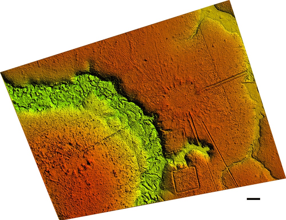
Using remote laser scanners installed in helicopters, a group of archaeologists linked to six institutions in the UK, Brazil and Spain, including UPF, have discovered a set of ancient settlements (Mound Villages) arranged in clock form beneath the vegetation of southern Amazonia.
The findings, dating from the 11th to the 12th centuries AD published last December in Journal of Computer Applications in Archaeology, were made possible thanks to LIDAR scanning technology, the same long-distance depth detection technique as found in driverless vehicles and the latest iPhones.
“I have participated in the excavations at the various archaeological sites, and before the fieldwork, in the process of identifying sites using satellite imagery”, Jonas Gregorio de Souza explains.
According to José Iriarte, a researcher at the University of Exeter (UK) and first author of the article, “LIDAR has allowed us to detect these settlements and their characteristics, as well as the roads that join them, which was not possible before because most are not visible from the best available satellite data”.
Instead of analysing each mound separately, as they used to, the researchers were able to see the outlines of entire villages and the connections between them via a RIEGL VUX-1 UAV LIDAR sensor integrated into an MD 500 helicopter, which monitored the forest from an aerial view.
The scans showed how the villages, built between 1000 and 1650 AD located in the south-east of Acre state in Brazil, were organized to represent very specific social models, with no apparent signs of hierarchy. “The uniform spatial layout of the mound villages, like many contemporaneous ring villages of the Neotropics, are likely to be physical representations of the Native American cosmos”, the researchers assert.
A structure of villages of different shapes connected by roads
The archaeologists found between 3 and 32 mounds at each archaeological site (dedicated to dwellings or cemeteries, among other functions to be determined by future research), with a height of three metres in some cases, and a length of up to twenty metres. LIDAR also discovered sunken minor roads and long, principal roads with high banks, which radiated from the mound villages like rays of sun or the hands of a clock.
In total, the archaeologists studied around 36 villages, some just 2.5 km apart. In addition to circular and elliptical villages, the researchers also found some arranged rectangularly.
UPF participation in the research
Jonas Gregorio de Souza, a Marie Curie researcher and member of the CaSEs Research Group of the UPF Department of Humanities, co-author of the article, explains his role in the research: “I have participated in the excavations at the various archaeological sites, and before the fieldwork, in the process of identifying sites using satellite imagery. I have also taken part in the development of statistical models that prove the regularity of the distribution of the mound villages and their connecting roads”, he explains.
Regarding the importance of these findings, the UPF researcher stresses that “the importance of the discovery lies in the fact that it was believed that this was a little exploited forest region, with the presence of small settlements, but now we know that it was densely occupied before contact with Europeans, with many villages connected to each other by straight roads, in a veritable regional system. Similar systems exist in other parts of the Amazon, but they were not known in the region where we are working, which was thought to have been sparsely inhabited for centuries”.
The six institutions participating in this research are University of Exeter (UK), Federal University of Pará and Federal University of Acre (both in Brazil), and Pompeu Fabra University, in addition to the National Institute for Space Research and the Instituto do Patrimônio Histórico e Artístico Nacional do Brasil.
Reference article:
Iriarte, J., Robinson, M., de Souza, J., Damasceno, A., da Silva, F., Nakahara, F., Ranzi, A. and Aragao, L., 2020. “Geometry by Design: Contribution of Lidar to the Understanding of Settlement Patterns of the Mound Villages in SW Amazonia”. Journal of Computer Applications in Archaeology, 3(1), pp.151–169. DOI: http://doi.org/10.5334/jcaa.45
