The project
About Intermaps
INTERMAPS is a project led by Maria Rodó-Zárate, based at the Pompeu Fabra University (Barcelona) and funded by the European Research Council (ERC Starting Grant, 2021).
It aims to contribute to the study of inequalities and discriminations by proposing a specific framework that can establish a systematization and characterization of intersectional dynamics.
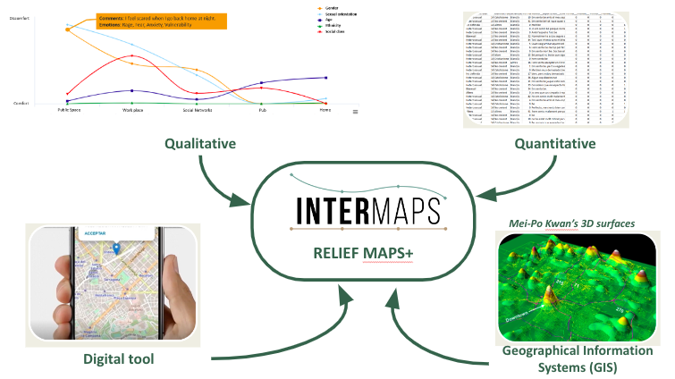
It includes a new theoretical model for conceptualizing intersectional inequalities from a spatial and emotional perspective and the development of new specific methods that combine and integrate qualitative, quantitative, digital and spatial (GIS) approaches.
INTERMAPS wants to contribute to the understanding of how structural inequalities are (re)produced and how they differently affect people’s everyday lives, building bridges between feminist and postcolonial theories, critical geographies and political and social sciences.
Objectives
INTERMAPS aims to make a twist on the course of research in intersectionality studies by proposing a new theoretical and methodological model that, while maintaining the original purposes of the concept, develops a specific framework that can establish a systematization and characterization of intersectional inequalities and provoke a significant shift in how intersectional dynamics are understood.
The main objectives are:
1. Theoretical
INTERMAPS developed a new theoretical model for conceptualizing intersectional dynamics based on three innovative approaches:
a) the consideration of the relation between categories through a properties framework and a pluralist and contextual approach,
b) a conceptualisation of space as constitutive of intersectional dynamics, and
c) an incorporation of the emotional dimension of intersecting inequalities.

2. Methodological
Relief Maps have been expanded into a theoretical and methodological framework that:
-
combines qualitative and quantitative data,
-
integrates digital tools for data collection and analysis, and
-
incorporates a GIS-based version that allows the mapping, analysis and visualisation of intersectional inequalities.
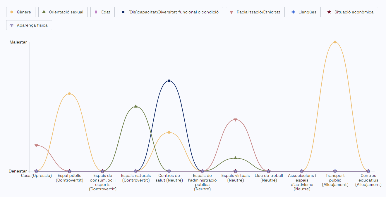
This model includes intersectional recoding, spatial analysis techniques and in-depth qualitative work with narratives, making it possible to identify patterns of:
-
who (which social positions) experiences inequality and discrimination,
-
why (which axes and causes are involved),
-
where (which specific contexts and places), and
-
how these experiences are configured emotionally and qualitatively.
In this way, Relief Maps operate both as a concrete set of tools and as a broader methodological reference for mapping intersectional dynamics.
3. Intersectional sampling
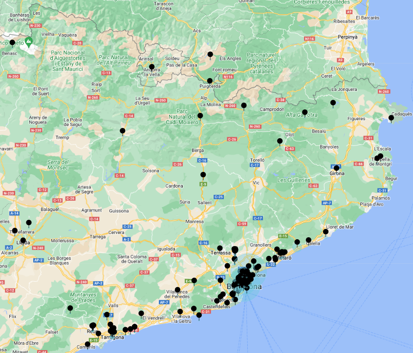
The INTERMAPS model has been applied to a large-scale empirical study in Catalonia (Spain), following an intercategorical approach (McCall, 2005) that considers multiple dimensions and axes of inequality across the general population (8 years and older).
Through Relief Maps, the project has generated:
-
intersectional profiles of 1,009 people,
-
information on their experiences in 11 everyday spaces, and
-
3,705 georeferenced points with 2,521 coded comments.
This dataset has made it possible to analyse intersectional dynamics in themselves, to create new indicators of intersectional inequality and discrimination, and to produce a spatially situated characterisation of these dynamics.
INTERMAPS demonstrates that it is possible to map, visualise and analyse intersectional inequalities while maintaining their complexity and contextual specificity.