Methodology
CAMP combines cutting-edge approaches from Ethnoarchaeology, Archaeology, Earth Sciences, Biochemistry, Geography, and Geostatistics to identify chemical and biological markers of pastoral activities from the anthropogenic deposits and to use such markers to develop models for the interpretation of pastoral sites.
CAMP will study dryland pastoralism through a two-pronged approach:
- The ethnoarchaeological investigation of currently inhabited and abandoned pastoral settlements to identify the markers and create a reference framework to develop the interpretative models;
- The study of archaeological pastoral sites to generate a new archaeological record that will be interpreted by applying the models built in the ethnoarchaeological study.
The ethnoarchaeological work includes the detailed topographic mapping of sites’ features and a spatially-driven sediment sampling strategy. The mapping will allow for the spatial contextualization of the recorded activities and of the samples connected to such activities. All samples will then be chemically characterized using a portable X-Ray Fluorescence instrument (pXRF), and patterns of variance and co-variance will be explored by geostatistical modelling. Selected sediment samples will be subjected to specific tests to extract additional proxies (i.e., phytoliths, organic residues, isotopes). Such an approach will create a framework of reference for the interpretation of the archaeological record. The archaeological sites will be sampled using the same strategy and the presence and variability of identified markers scrutinized by means of the geostatistical models previously developed in the ethnoarchaeological investigation.

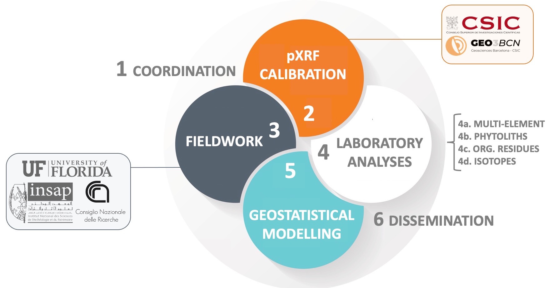
CAMP’s objectives are pursued through a coordination work package (WP1), four interrelated and research-oriented work packages (WP2 to WP5) and a work package related to results communication and dissemination (WP6).
WP1: Coordination and management
The PI will coordinate the project and supervise its development.
WP2: pXRF calibration
Main objective:
- To develop a specific pXRF calibration for the study of anthropogenic sediments that allows the generation of qualitative and quantitave data.
WP3: Fieldwork, topographic mapping and sampling of inhabited/abandoned settlements and archaeological pastoral sites
Main objectives:
- To provide detailed digital maps of the selected inhabited/abandoned settlements and archaeological pastoral sites acquired via RTK Differential GPS (DGPS);
- To carry out systematic sediment sampling of anthropogenic deposits.
WP4: Laboratory analysis
CAMP envisages a two-pronged analytical procedure. The first phase (WP4a) focuses on extensive and non-destructive multi-element chemical analysis of the collected ethnoarchaeological and archaeological sediment samples. The second phase focuses on the analysis of phytoliths and organic residues (WP4b-d).
WP4a – Multi-element analysis
- To identify the chemical signatures of anthropogenic deposits from inhabited/abandoned settlements and archaeological sites by means of pXRF analysis.
WP4b - Phytolith analysis
- To create activity signatures from plant micro-remains;
- To acquire new data on plant use by pastoral groups (e.g., fodder, food, dung etc.).
WP4c - Organic residues analysis
- To explore the application of organic residue analysis to the identification of anthropic activities;
- To acquire data on animal and dairying food products directly from anthropogenic deposits
WP4d - Isotopes
- To develop experimental protocol to extract isotopes from the anthropogenic deposits.

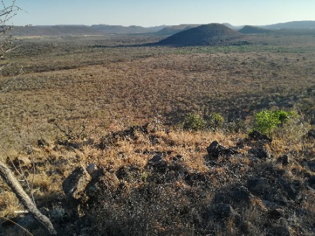
Dry savannah pastoral landscape in Botswana
WP5: Geostatistics and modelling
Main objectives:
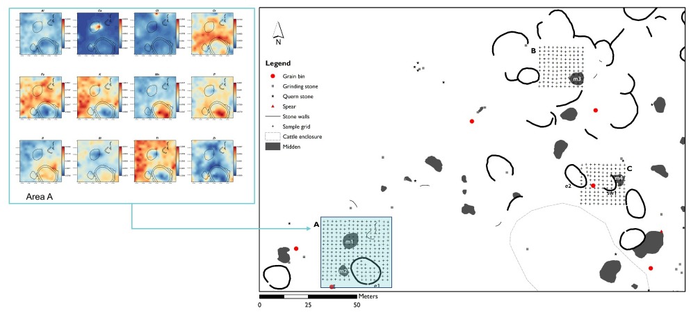
- To produce models, through geostatistical techniques (Kriging), of the distribution and co-variance of chemical elements in the anthropogenic deposits;
- To create descriptive models that combine geostatistics and phytoliths and organic residues to interpret the use of space at the site level;
- To apply the models built in the ethnoarchaeological case studies to the archaeological sites to generate an archaeological record;
- To provide an open-access code for geostatistical modelling;
- To provide an exhaustive open access reference dataset (repository) of the identified signature from inhabited/abandoned pastoral settlements.

Example of the application of the proposed methodology in the pilot project (published Biagetti et al. 2021)
WP 6 Dissemination
CAMP’s results will be published open access in academic journals and disseminated through participation in international conferences, a series of purposely organized workshops, and a final international conference. All data and results from CAMP will comply with codes of FAIR, CARE and open access practices and will be stored in the CORA Research Data Repository (RDR).
