Relief Maps+, an innovative research tool developed by UPF to measure social inequalities
Relief Maps+, an innovative research tool developed by UPF to measure social inequalities
Relief Maps+, which uses an intersectional, emotional and spatial perspective, was recently presented on the University’s Ciutadella campus, in an event featuring individuals from academia, social movements and public authorities. The initiative is part of the European research project INTERMAPS, led by Maria Rodó-Zarate, a researcher in the Department of Political and Social Sciences at UPF, which will launch the tool among a sample of 1,000 people in Catalonia.

On 8 November, the INTERMAPS research project team from the Department of Political and Social Sciences at UPF presented, on the Ciutadella campus, Relief Maps+, a tool for collecting, analysing and viewing data on the intersectional dynamics of social inequality and discrimination in daily life, from an emotional and spatial perspective.
Relief Maps+ incorporates a number of improvements in terms of user-friendliness and content over the previous model, created by Maria Rodó-Zárate, coordinator of the Research Group on Gender and Inequalities (GRETA) and principal investigator for the INTERMAPS project, for which she received a Starting Grant from the European Research Council in the 2021 call for applications.
Maria Rodó-Zárate: “With this digital tool, we can see how people in Catalan society experience inequalities in their daily lives based on their social position, which is determined by factors such as age, gender, race and class”
The aim of the INTERMAPS project is to shed light on how structural inequalities are (re)produced and the different ways in which they affect people’s daily lives, and it does so by studying social inequalities on a theoretical, empirical and methodological level. The creation of Relief Maps+ falls within the scope of the latter.
“With this digital tool, we can see how people in Catalan society experience inequalities in their daily lives based on their social position, which is determined by factors such as age, gender, race and class,” explains Maria Rodó-Zárate.
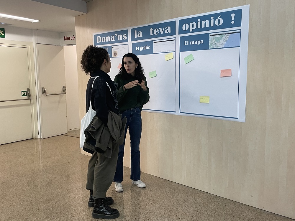
During the event held on the Ciutadella campus, the INTERMAPS research team outlined the progress achieved in the research over the past year and shared the new digital Relief Maps+ tool, which is at the heart of the project.
The event was a meeting point for individuals from academia, social movements and public authorities, who had the opportunity to test the tool and also provide feedback and suggestions for improvement.
What is Relief Maps, how does it work and what is it for?
Relief Maps was created by Maria Rodó-Zárate in 2014 as a qualitative tool for collecting, analysing and viewing the intersectional dynamics of everyday social inequality, from an emotional and geographic perspective.
First digitised in 2018, the INTERMAPS project has resulted in the development of an improved version. While the new tool retains some of the characteristics of the earlier model, it also boasts several new features.
Relief Maps consists of three steps through which participants reflect on the oppression and privilege they experience for diverse reasons, in different places in their everyday lives. It therefore incorporates three dimensions into one single image: the social dimension (e.g. gender, sexual orientation, social class, ethnicity), the geographic dimension (places) and the psychological dimension (emotions).
Relief Maps proposes a specific method for collecting data on intersectional inequalities which goes beyond the dichotomous interpretations of quantitative and qualitative approaches
In this regard, the tool visually displays the contours of comfort and discomfort (treated as holistic terms that may include a broad range of specific emotions). These emotional maps situate experiences geographically based on the spatial nature of social relationships, distinguishing positions and effects, taking into account oppression and privilege and using emotions as indicators of inequalities.
Relief Maps proposes a specific method for collecting data on intersectional inequalities which goes beyond the dichotomous interpretations of quantitative and qualitative approaches. It also distinguishes between quantitative and positivist epistemological methods, proposing a manner in which a qualitative method based on critical, feminist and geoparticipatory approaches may be used to research inequalities and discrimination.
As part of the INTERMAPS project, the research team will launch Relief Maps+ among a sample of 1,000 people in Catalonia in the coming months. This new sample cohort will include the general public, with no specific restrictions: only people who are under 8 years old and do not live in Catalonia will be excluded.
Once the tool has been consolidated, the research team plans, in the future, to make it public and extend access to all people, be them academics or researchers, individuals from public authorities or social movements or students.